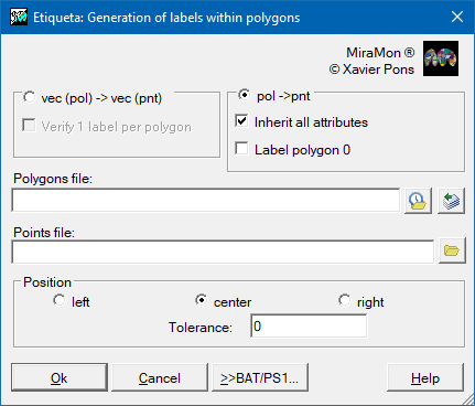
| Presentation and options | Dialog box of the application |
| Syntax |
A polygon is a bidimensional geometrical figure which describes a closed area. In MiraMon, it also is an entity which is topologically described by a succession of arcs that define its boundaries. Polygons can have geometric-topological attributes (such as the area) and thematic attributes (such as the type of vegetation present in that polygon) associated. A possible way to transfer or associate the thematic attributes to the polygons (topological geometries are automatically generated by MiraMon) is with a point inside each polygon; every point will have associated the attributes that have to be transferred to the corresponding polygon. In the case of the POL format, as many attributes as desired can be transferred and, in addition, several records with the same attribute structure (fields of a table) can be transferred: for example several owners of a parcel into single records (multi-record), each with as many fields and attributes (owner name, surname, etc.) as necessary. In the case of the VEC format only one attribute and one record is supported). These points are named labels and the process by which attributes are transferred to the polygons is named labelling (AtriPol, AtriTop). Sometimes though, the inverse process is needed, that is, to get the labels needed to label the polygons from the polygons themselves. This interest can come from issues of cartographic aesthetics (the position of the automatic labeling generated by the symbolization functions of the program are not satisfactory enough) or from issues of geoprocessing (the topology from the beginning has been reconstructed and the all tags have to be re-applied, perhaps removing or adding some, adding or removing records in case of multiple records, changing attributes, etc). For geoprocessing purposes it is not always necessary to work with labels, and from version 9 of MiraMon the digitization of vector layers with interactive topological structuring allows solving most issues visually.
This program allows to generate points which are labels of polygons from a POL file (topologically structured or not), or a VEC file VEC (which is always an explicit polygon file with explicit polygons). The new generated labels can, or can not, get the preexisting attributes of the polygons and are written in the same order as in the original polygons. The program allows if desired, or not, to place a label on polygon zero (the external polygon, or the universal polygon, that envelopes the rest of polygons).
Labels can only be generated in a totally automatic and correct way from a file which has topology (POL) or, in the case of a VEC file, when there are no overlapping polygons. In addition, in the case of VEC format, any polygon can have inner islands (polygons within polygons), reason by which, in the case of VEC files there is an option to check errors when labels are generated.
For POL files that contain groups, such as an archipelago of islands, a label is generated for each elemental polygon.
The position of the point in the Y dimension is close to the arithmetic mean of its coordinates. The position of the point in the X dimension can be established either by a distance which is equal to the tolerance (indicated in the command line) of the right or left boundary of the polygon, or as much to the center as allowed by the geometry of the polygon.
In the case of a VEC file, a better result is obtained if the tolerance is small and the points get very close to the boundary of the polygons. In contrast, in the case of POL files, we can choose to label polygons with the center option, since this is aesthetically better.
When the original file is a VEC file the resulting files is a VEC file of points; in the case of a POL file, the resulting files is of type PNT.
 |
| Etiqueta dialog box |