-
 GPXMM: Import and export between GPX and MiraMon format
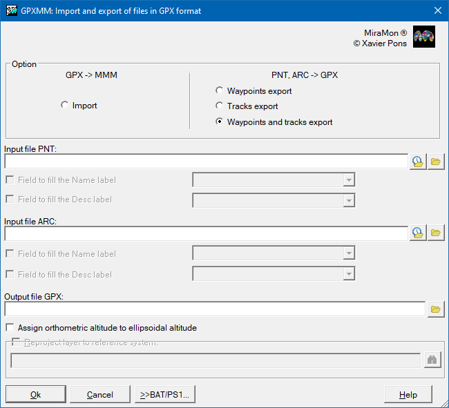
GPXMM: Import and export between GPX and MiraMon format| Presentation and options | Dialog box of the application |
| Syntax |
This application is used to convert a GPX format file (GPS eXchange Format) into MiraMon structured vector format (PNT, ARC/NOD) and viceversa.
A GPX file is a format based on an XML scheme that is intended for data sharing from GNSS receivers (popularly known as GPS) between different applications. This file may contain several points of interest of interest (waypoints), tracks or routes. More detailed information about the structure of a GPX file can be consulted in this webpage.
In a GPX file importing, the output files will detach from the type of existing data in the input file. If it contains tracks, an arc structured vector file (.arc) will be created. If the GPX file contains points, a point structured vector file (.pnt) will be created. If the GPX file contains tracks (sets of points that define a route to be followed), a structured vector file of points will be created for the points of interest and also another structured vector file of arcs that joins them forming a possible trace between them. In any case, a MiraMon Map (MMM) file will also be created where all the imported data can be seen. In relation with alphanumeric data, all the attributes defined for the points of interest are saved (consult attributes) and for routes (check attributes) that the GPX file contains. Moreover, in the case of tracks, the initial and final time of the track (timestamp) will be also saved in Universal Time Coordinated (UTC) and the minimum and maximum ellipsoidal altitude.
The application structures topologically the imported layer.
In exporting from PNT and/or ARC/NOD format file to a GPX file, and due to the limitations of the GPX format, the program allows to save the attributes of a single field of the table associated with the PNT and/or ARC/NOD file; this attribute will be the <name> of the points of interest and/or tracks of the destination file. In case of not assigning any field, the field will be filled, by default, with the name of the file followed by the graphical identifier of the corresponding point or arc.
According to the specification of GPX format, file data coordinates are relative to WGS84 datum and the measurement unit is meter. However, this application allows the reprojection from the GPX file data to another reference system during the import process. For more information about reference system, ythe file MiraMon horizontal reference systems. Geodesic tables and files can be consulted for further information.

 |
| GPXMM dialog box |