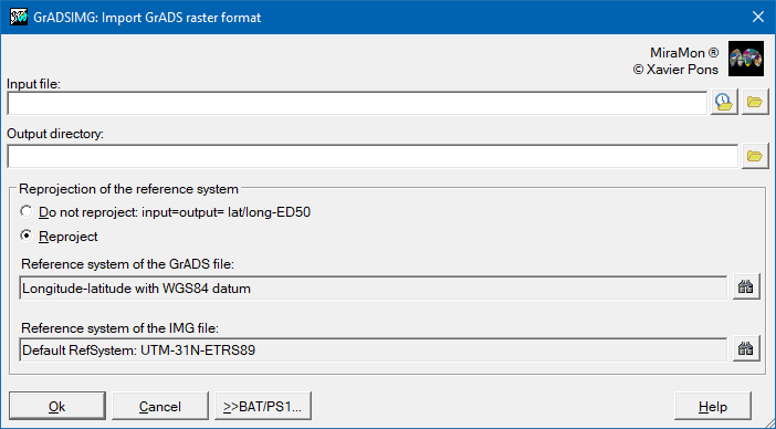
| Presentation and options | Dialog box of the application |
| Syntax |
GrADS stands for Grid Analysis and Display System, an environment frequently used in meteorology.
The typical data models used are 4D grids with dimensions: longitude, latitude, level and time that contain various bands relative to continuous quantitative variables such as temperature, wind speed, etc. Importation of a GrADS file gives rise to a series of temporary rasters in a series of height layers such as, for example, geopotential pressure heights. All the bands generated in the import are saved in the same directory, that is one of the parameters in the syntax of the program. Their file names however are fixed by the short name assigned to each variable for its elevation layer and for the time sequence. For example, the file corresponding to the variable t_dry (temperature) at a level of 850 mb and for the first time series will be called: tdry_850_t0.img.
The total number of IMG rasters generated will be the product of: levels · time_series · variables, and they will be accompanied by their respective documentation files doc or by a single metadata file I.rel if they are to be treated as a band set.
The program allows the data to be reprojected from the original reference system to a different chosen system. In this case it is necessary to identify the original reference system from amongst those reference systems supported by MiraMon, and to choose the output reference system.
It is not necessary to reproject the data, in which case the program will document the resultant raster as having the Latitude-Longitude reference system with the ED50 Datum.
For more information on the specifications of this format go to: http://grads.iges.org/grads
 |
| GrADSIMG dialog box |
GrADS is a registered trademark of The Institute of Global Environment and Society, Inc. (IGES), Maryland