-
 Vec3D: Obtain 3D vectors from DEM
Vec3D: Obtain 3D vectors from DEM| Presentation and options | Dialog box of the application |
| Syntax |
This application incorporates the third dimension into unstructured vector files (VEC) or PNT or ARC files based on the Digital Elevation Model (DEM) of the same area. The POL and NOD files acquire the third dimension when the linked ARC files are ARC 3D, so to convert a POL file to 3D, the Vec3D must be run on the corresponding ARC file (located in the same directory as the POL file).
The application allows the use of a DEM covering an area smaller than the vector file and also supports vertices over NoData areas in the DEM. In this case it assigns NoData values to the heights of the vertices outside the raster extents or over NoData pixels in the raster. The application also allows 3D files to be used as input. In this case it overwrites the height values except where the points are outside the extents of the DEM raster or in areas with NoData in the DEM in which cases the original 3D values are kept.
The number of vertices can be enriched with new vertices when the origin structured vector is a structured vector of arcs. This profile will consist of a new arc structured vector with new 3D vertices added to the existing ones. The new vertices are generated by dividing each of the original segments in new segments with length equal to cell size of the DEM, with the exception of the last segment which has the residual length. The Z coordinate of every vertex is obtained from the DEM by means of a chosen interpolation method (nearest neighbor, bilinear interpolation, bicubic interpolation).
In the case of PNT files, if the Z coordinate has also to be in the corresponding alphanumeric attribute table (*T.dbf) run the PNTBD application.
Final note: for arc files that have been "cycled", if the application is used to overwrite the original file then the files of linked polygons are promoted to 3D polygons. Otherwise the new arc file looses the links to the "cycled" polygon files.

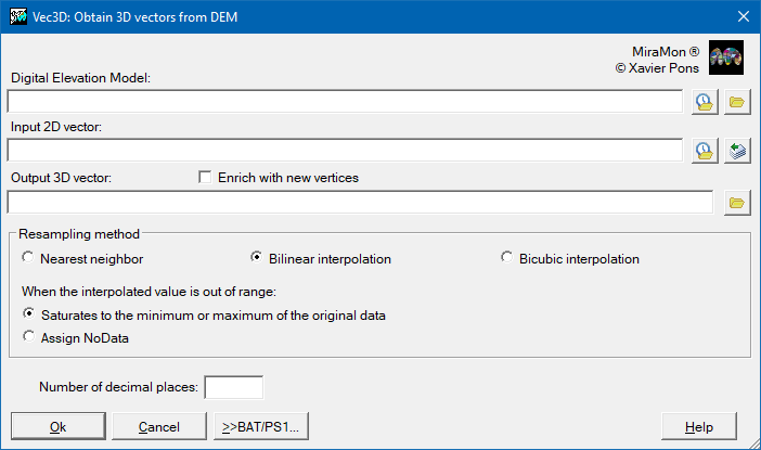 |
| Vec3D dialog box |