 |
Cartography on Internet with MiraMon |
| Cartographic bases in MMZ format and the MiraMon Universal Map Reader | Favorite map collections |
| MiraMon Map Servers and Browsers |
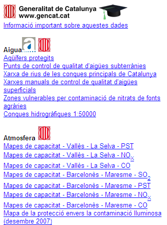
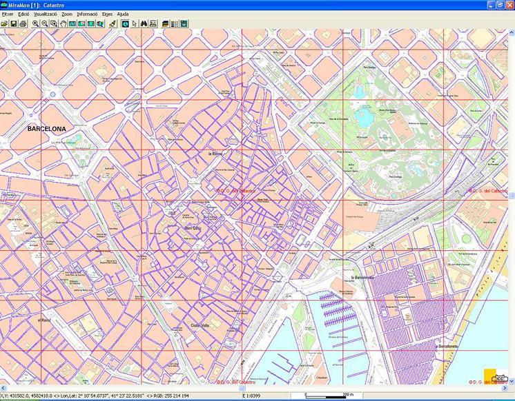
Cartographic bases in MMZ format and the MiraMon Universal Map ReaderThe MiraMon Universal Map Reader is a free program that allows the visualization, query and printing of maps published on the Internet or in CD/DVD. Maps distributed on the Internet must have been generated with MiraMon under a specific certification license called MiraMon Internet Map Publisher. The information is saved in a compressed format (MMZ), generated with the most advanced data compression algorithms, which can contain MiraMon Maps (with raster, vector layers, OGC standards, geodatabases, etc) and/or other documents (text documents, word files, excel, html pages, images, sounds, etc). The MiraMon Universal Map Reader allows you to consult layers by location (clicking anywhere will tell what is there) or by attributes (you can ask the map to locate a certain element, such as a sewage treatment plant, or a certain phenomenon such as weather stations with an average January temperature below 5°C. The idea of the MiraMon Universal Map Reader, unlike many GIS through the Internet, does not consist of giving a simple screen overturn or a small selection of data, but offering access to the data itself, so that the user can consult and exploit them as thoroughly and as many times as it is desired. The use of this compressed format allows a saving of time and money that benefits the user and the entity that serves the data. The Universal Map Reader of MiraMon opens the door to all the information with a simple click, not in a simplistic way, but based on a high-performance product like the Professional MiraMon. Data security is guaranteed by the certification included in the compressed files (MMZ format) by the entity issuing the information as the MiraMon Universal Map Reader checks the integrity of the certificate before displaying the data and making it accessible to the user the name of the certification body. Some examples of mapping servers using the MMZ format and the MiraMon Universal Map Reader are: https://www.miramon.cat/USA/MMZ.htm Favorite map collectionsThrough the favorite collections the access to all the MMZ cartography prepared by different organization. To access, click on the map collection indicated with the following image:  From there is the access to the list of maps: Favorite map collections allow quick access to the data, which is especially useful when using the same map base repeatedly. Favorite collections can be downloaded from the program input interface via:  Any users can create their own favorite collections with their maps of interest. MiraMon Map Servers and BrowsersThe MiraMon Map servers/browsers offer many advantages such as a very higher access speed, downloading of real data, etc. using standardized communication protocols developed by the Open Geospatial Consortium (OGC). El MiraMon Map Browser (MMB, for MiraMon Map Browser) allows to read, from an Internet browser and without the need for any type of plug-in or additional resource, cartographic layers from OGC specifications aimed at standardizing access to cartography through navigation systems based on Internet protocols WMS, WMTS, WFS, WCS) resulting from MiraMon servers or from other developers that provide the data following these specifications. For more information, consult Navigate over OGC servers (WMTS, WMS, etc). On the other hand, MiraMon Map Server (MMS, for MiraMon Map Server) allows to prepare and serve layers following the same OGC specifications, so that they can be read by any application under the specifications; In addition, both the MiraMon and the MiraMon Universal Map Reader, besides being able to act as browsers on WMS servers of any manufacturer, are especially efficient when they are clients of MMS servers in local network (LAN) environments. Some peculiarities: MMB: Based on an HTML portal and the Javascript (JS) standard, fully consolidated since 1990, it has achieved a single unified portal that incorporates all the features requested by users. For example, for the Departament de Territori i Sostenibilitat de la Generalitat de Catalunya and its satellite image server of the Documentation Center, a client that makes Web CoverageService (WCS) requests and allows to change the styles in the layers (false color, real color) has been developed. On the other hand, for the sociodemographic data server based on data from the Instituto Nacional de Estadística de España, a system of cinematographic animations has been developed to visualize temporal data sequences; this same service has also been incorporated into other MiraMon browsers, such as the orthophoto of the CREAF intranet or the satellite images mentioned above. Finally, MiraMon browsers can be multi-idiomatic. MMS: The Create MMS module allows to prepare layers, initially in cartographic series or in single layer, of raster type (with continuous or categorical quantitative data) and of vectorial type (points, lines or polygons). The layers maintain the link with the original alphanumeric databases (in the usual formats DBF, MDB, Oracle, MS-SQL Server, etc) and allow, if the administrator wishes, to serve file downloads in MiraMon format (MMZ) or others (GeoTIFF, georeferenced JPEG, etc.) following the WCS specification of the OGC. Infraestructura de DadesEspacials de Catalunya (IDEC) en l InstitutCartogràfic de Catalunya (ICC) website has adopted this system for the distribution of its 1: 25000 orthophotos over the entire territory of Catalonia. In addition, the administrative tool for managing browsers and servers allows defining the general presentation and layers included in browsers, as well as the administration of map servers defining the layers that are offered and the general properties of the service. It should be noted that it has multi-language support (including legends). Note that this application can not only be used to generate applications for the Internet or an intranet, but also to prepare layers in MiraMon-WxS format that can be read from MiraMon on personal computers and local area networks without the need for any type of Internet server.  WMS Server of the Oficina Virtual del Cadastro open with MiraMon. Some examples (both of navigation systems and servers) made with MiraMon following the OGC standards are: |